Article Series
Author: Rehabilitation Alliance Hong Kong
Publication Year: 2024
The previous units were about some more principled sharing, and the following chapters will be more personal, focusing on different facilities in the manual. First, I would like to share with you the situation of tactile maps. Everyone must know what a map is, but what is a tactile map? Where is it placed, and what should you pay attention to? Do you all know?
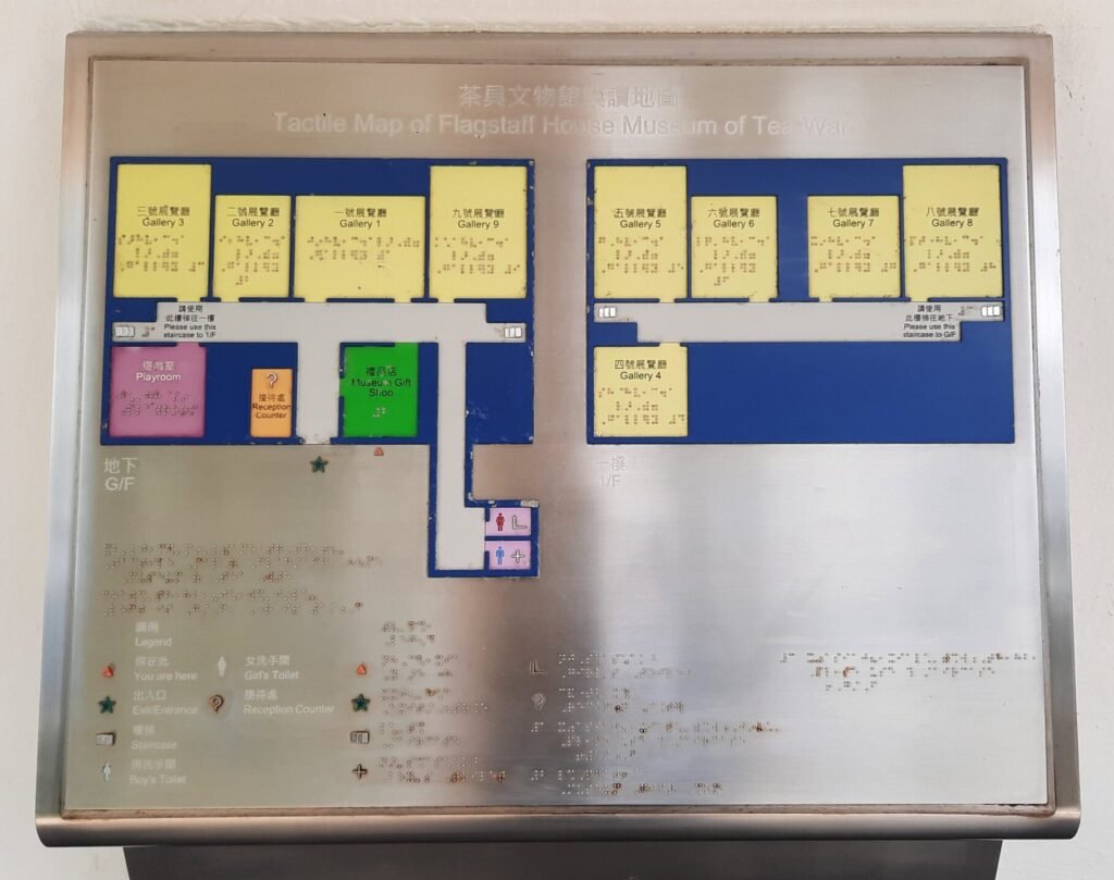
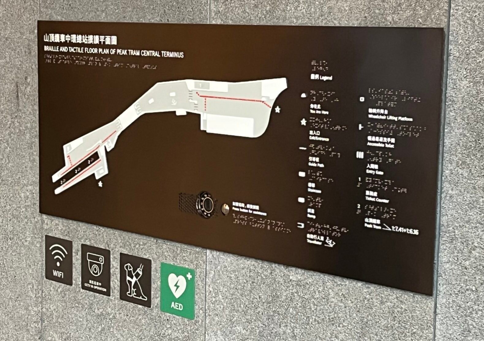
When you go to parks, shopping malls, or subway stations, have you noticed the location near the main entrances? There is usually a map with tactile symbols and Braille that helps visually impaired individuals locate themselves and understand the layout. The map will have different tactile patterns indicating different meanings, such as your current location, stairs, entrance locations, inquiry points, etc.


But has anyone noticed that the setup of tactile maps can vary greatly? The existing design manual standards do not establish any standards for the setup of tactile maps, meaning that parametres like map height, tilt angle, materials, and limits on graphic representations are not explicitly defined. While there are accessible facilities, they do not meet the required level of accessibility, and visually impaired individuals still face many difficulties in usage.
We share some real examples: a newly opened museum has placed a tactile map at the main entrance, but it is a giant tactile map, and the highest line of Braille is out of reach even for an adult visually impaired man. Additionally, the information contained within is vast, and one or two touches are insufficient to fully grasp it;
another tactile map is located outside the mall’s main entrance, sized appropriately but set at waist height, mounted vertically on the wall, requiring visually impaired individuals to squat down to read it and the design does not take the extent of wrist flexion into account.

Some tactile maps are positioned outdoors, made of metal materials without shading, and during the day, as temperatures rise, they become akin to a scorching hot iron plate, which can burn a visually impaired person’s hands upon touch.
Finally, tactile maps can be used not only by individuals with visual impairments, but also by the general public to understand the venue’s information. Therefore, tactile maps should be developed with accessible standards. Do you have any observations or thoughts? Feel free to leave comments and share with us.